
Artzi site
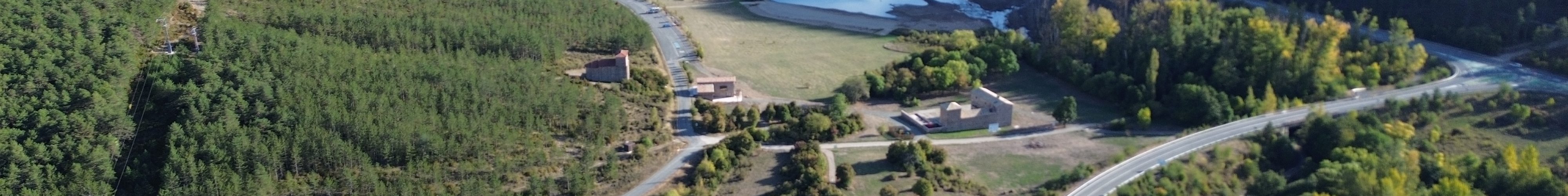
This site is located in the area called El Soto, in the municipal territory of Artzibar/Arce Valley, 25 km from Iruñea/Pamplona (to the northeast of Navarra), between the towns of Nagore and Zandueta. It is within the Artzi/Arce Estate, although all that remain standing now are the palace, Santa María Church and the remains of some dwellings.
The archaeological remains are on the east bank of the Urrobi River, to the north of the NA2040 highway. This highway was built in 2004 and divided the area, with the church and palace lying to the south of it.
This site has always been linked to the Roman road, as it is only a few metres away from it. According to the information that we have today, it ran along the west bank of the Urrobi River and crossed southwards through the entire Valley. The road has now been made suitable to explore on foot. You can find more information about the trail in Follow the Trail.
FOR FURTHER INFORMATION:
Further information and images from the Artzi site
Information about the Artzi site on the Town Council’s website
Article about the site
Short article published in 2021 in Trabajos de Arqueología de Navarra on the archaeological digs (available on PDF).
Location
Location of the site.
Ready to travel to the third century?
Listen carefully to the story that Ur de Artzi tells us.
SITE IDENTIFICATION AND RESEARCH CONDUCTED
The material found on the surface from the Roman period was one of the first signs of the existence of a Roman site in the Artzi area. These remains were found by members of the Aranzadi Society of Sciences group after the new highway was built.
In 2012, the initial archaeological surveys were carried out and, although it was impossible to identify any structures, a large number of materials from the Roman period were documented. From 2014, various geophysical surveys were carried out. Without having to extract any soil whatsoever, the existence of a complex composed of several buildings was confirmed in the area.
Since 2015, archaeological digs have been carried out every summer. Thanks to them, numerous remains have been recorded, offering further information about the characteristics and development of this settlement.
The combination of both methods has shown that the complex is around 1 ha in size, made up of different kinds of building structures which, consequently, have varying degrees of preservation. Thus far, no structures have been identified to the north of the NA2040 highway that connects Nagore to Lakabe, but it is possible that the site extends to the south.
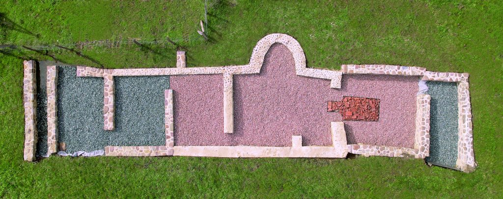
THE BATH COMPLEX
This is the most widely researched building to date, as it has been excavated continuously between 2015 and 2021. It is rectangular in plan and its dimensions are 20 m long and 5 m wide.
At least 7 room spaces have been identified and at least 2 of them would have been equipped with a heating system. These structures consisted of a hole under the floor for circulation (supported on stacks of bricks), also connected to the praefurnium or furnace. The hot air was distributed through the hole and it heated up the surface of the floor, while also rising through the tubuli or hollow bricks that were between the walls.

One of the most striking features of the complex is its similarity to the complex documented in Donazaharre/Saint-Jean-le-Vieux, a site located on the northern side of the Pyrenees, along the same road.
Although they stopped using the building for baths, it remained in use for a time during Late Antiquity, during which a subsequent phase has been documented with a large number of fragments from building materials, the skeletal remains of animals and common Roman pottery.
A large amount of iron slag was also found with these remains, suggesting that the complex was also used for production activities. The fact that there were mines in the Urrobi basin and surrounding areas during various periods of history suggests that this place may also have been used for activities related to metallurgy.